
It is hard to imagine navigating the streets of the world without help from Google Maps. However, while most of us use the app to find our way around, there are some people who use the Google Earth option to ‘travel’ the world or look for interesting occurrences in the endless collection of images.
One Imgur user could put Google Earth under his hobbies, as the guy spends a lot of time exploring various areas of the map and snapping screenshots of places he found most interesting. Posting under the name geologistsmakethebedrock, this man has shared a couple of galleries with the internet people, adding short descriptions to each image. “I really like to peruse Google Earth looking for cool things. My captions either come from basic internet research of my guess about what’s happening” he explained.
Most of his screenshots feature various land formations that draw the eye, as well as some man-made structures that seem to have a story behind them. Google Earth has been a thing since 2001, though back then it was only in the initial stage of what it eventually became. Within years the project evolved and from flat, often puzzle-like map we eventually got realistic 3D depictions of many countries across the globe. The project even expended further than Earth’s boundaries as Google launched such branches as Google Mars and Google Moon.
There’s a lot out there to explore, so if you’re lacking funds or the ability to go on long flights to see Norwegian fjords or Mexican deserts, power up the app and see where it takes you. Oh, but before that, don’t forget to check out what geologistsmakethebedrock shared and vote for your favorite snaps!
interesting earth finds
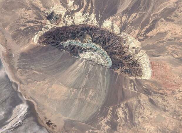
Image credits: imgur.com
“An anticline somewhere in Iran with a series of alluvial fans on the south side. I really like the blue color of the formation ringing the center of the anticline. I need to go there and get a sample. You can see the colors of the formations reflected in the fan.”
interesting earth finds
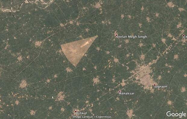
Image credits: imgur.com
“A strange shaped clearing in the Punjab province of India. I wonder what that is.”
interesting earth finds
Image credits: imgur.com
“Zoomed in on the funny shape. Looks like some sort of target for military aircrafts. It’s facing the Pakistan border and about 50 miles away… Probably not a coincidence. I hope they don’t miss by too much because the surrounding area is heavily populated.”
interesting earth finds
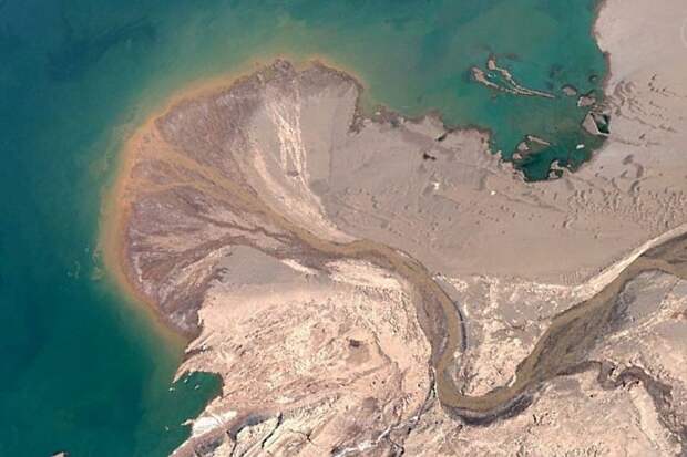
Image credits: imgur.com
“A cool delta building out into Ayyakum Lake, Tibet. The river is unnamed on Google. It is fed by snowmelt from mountains to the south. You can see some isolated sand dunes NW of the river. There is a name for this type of dune, but I can’t remember what it is. They happen when there is enough wind to migrate dunes, but not enough sand.”
interesting earth finds
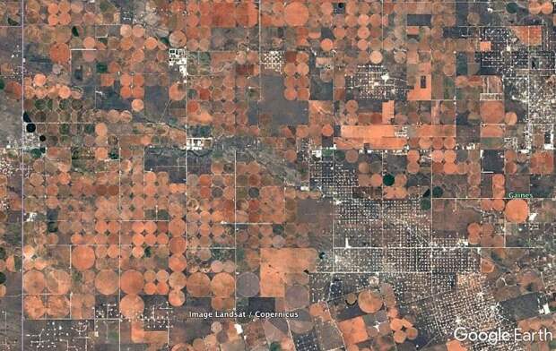
Image credits: imgur.com
“Irrigated fields in west Texas. The colors here are awesome. I’m guessing the crops were recently harvested or recently plowed under and we’re seeing the soil color. In my experience, harvested corn or wheat fields aren’t this orange/red. Any ideas? The white specks are oil pads connected by little roads. This land is certainly being utilized.”
interesting earth finds

Image credits: imgur.com
“A WWI gun battery/fortification around Verdun, France.”
interesting earth finds
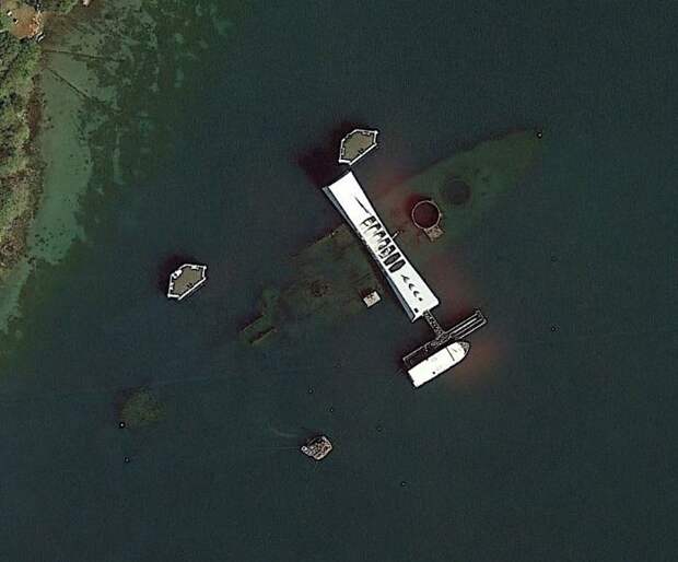
Image credits: imgur.com
“USS Arizona and memorial, Pearl Harbor.”
interesting earth finds
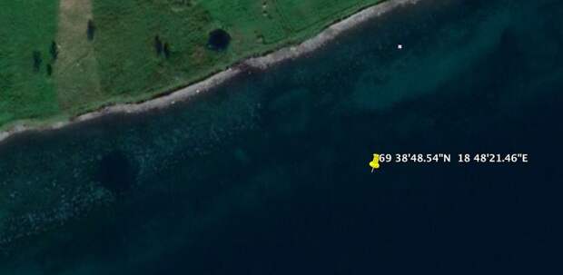
Image credits: imgur.com
“I read about this one on a forum. I think it’s true. The GPS point is the location of the German battleship, Tirpitz when it was sunk by British bombers on 11/12/1944. The Tirpitz was the sister ship of the famous Bismarck. It was also the last serious German surface naval threat. The RAF and Royal Navy played a long cat and mouse game with the Tirpitz as it hid out in Norwegian fjords. It was eventually located and Lancaster bombers attached at high altitude with huge bombs. The 3 round holes (2 in the water, 1 on land) are likely craters from missed bombs. They don’t make sense geologically”
interesting earth finds

Image credits: imgur.com
“Preserved craters from the D-Day bombardment of German fortifications at Pointe du Hoc, Normandy.”
interesting earth finds
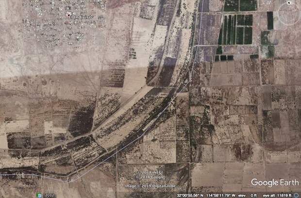
Image credits: imgur.com
“The grey line is the dried up bed of the Colorado River in Mexico. You can see all of the now useless farmland. US dams on the Colorado make it’s downstream reaches dry most of the time. This has not been so great for fishing and farming communities in the US and Mexico.”
interesting earth finds
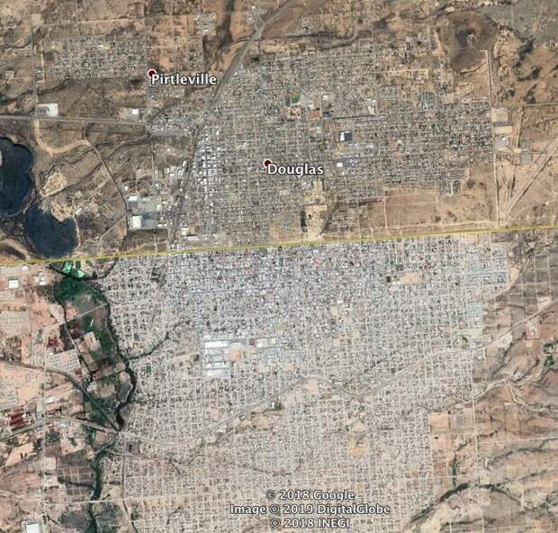
Image credits: imgur.com
“These are 2 border communities, US to the north and Mexico to the south of the yellow line. I’m not sure if the color change across the border is caused by Google stitching images or a difference in building materials.”
interesting earth finds
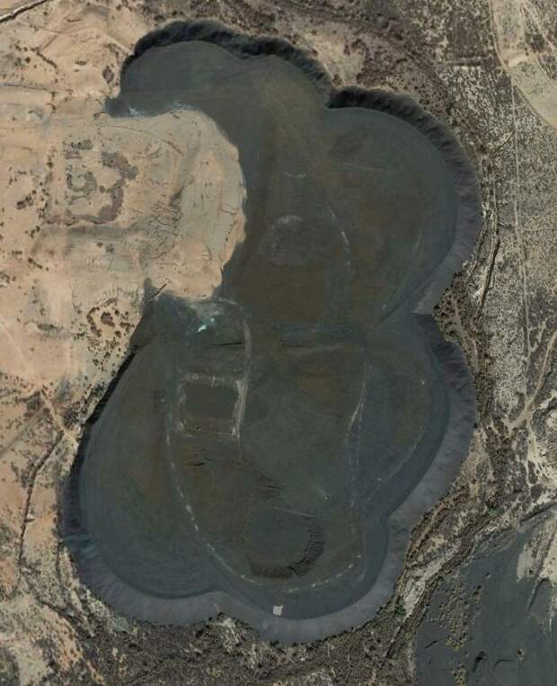
Image credits: imgur.com
“A huge pile of some black stuff due west of Douglas, Arizona. It looks like a spoil pile from a mine, but I don’t see evidence of a mine nearby. Any ideas?”
interesting earth finds
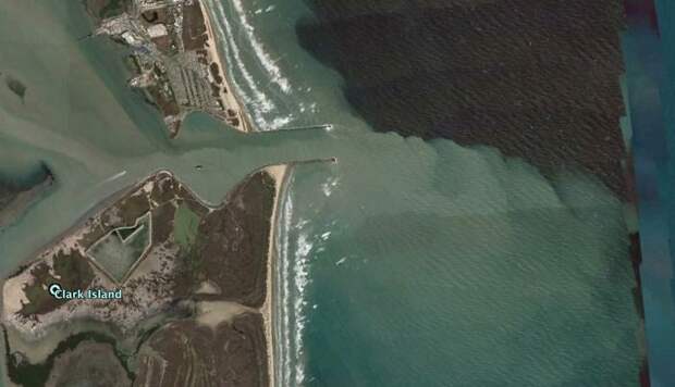
Image credits: imgur.com
“The Rio Grande River entering the Gulf of Mexico.”
interesting earth finds

Image credits: imgur.com
“Jack-up drilling rigs in port near Lake Charles, LA (USA).”
interesting earth finds

Image credits: imgur.com
“A breakwater and lighthouse on one of the Great Lakes. I can’t remember where. Notice the circular pattern of waves reflecting off the structure.”
interesting earth finds
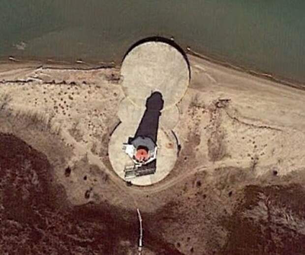
Image credits: imgur.com
“The Long Point lighthouse on the Canadian side of Lake Eerie. This one was curious because it has 2 foundations. I thought maybe it was moved like the Cape Hatteras LH. It wasn’t that cool though. This one was taken down and rebuilt on the new foundation in the early 1800’s. It has a pretty cool history. ”
interesting earth finds
Image credits: imgur.com
“This immediately caught my eye. Nature is usually not that linear. It has to be some sort of imaging issue, but even when zoomed in the lines look just like ridge lines with shadows on the west sides. It looks so natural up close. I know it isn’t a true feature though.”
interesting earth finds
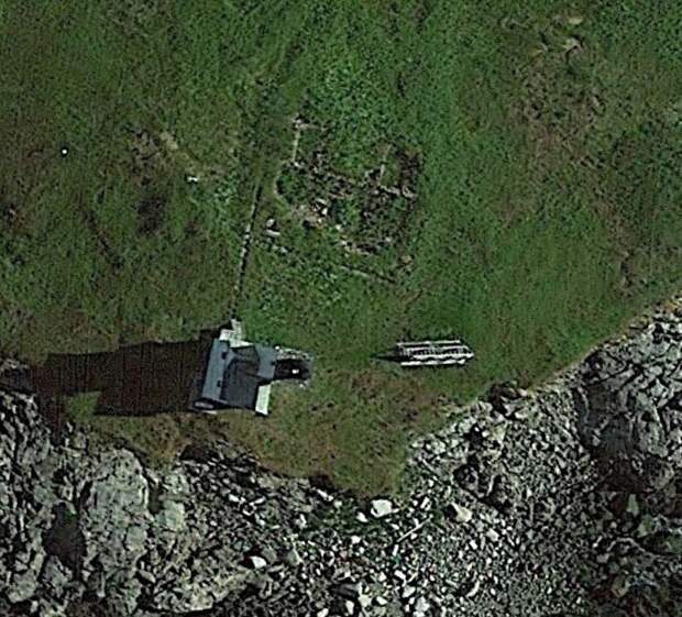
Image credits: imgur.com
“A lighthouse off the Maine coast. You can see the old foundation of the keepers house. These were usually built as double homes. They were super cool houses where each side is a mirror of the other. This was so 2 keepers and their family’s could take turns keeping the light and have their own little home on the island.”
interesting earth finds

Image credits: imgur.com
“A push boat and barges stirring up the bottom of the Tombigbee River in Alabama (USA).”
interesting earth finds

Image credits: imgur.com
“This is my favorite. It’s a marina near Milwaukee, Wisconsin (USA). The winter ice is in the process of breaking up. I don’t know why, but this is very visually appealing to me.”
interesting earth finds
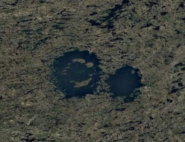
Image credits: imgur.com
“These are impact craters in the Canadian Shield, the oldest continental crust of the North American plate. Because it’s been tectonically inactive for a long time and continental glaciers removed most of the topsoil, many craters are visible. This lake is called Lac a l’Eau Claire. There is a lot of evidence that the lake is formed by 2 impact craters. It was originally thought that the 2 impacts were formed at the same time by an asteroid that split or was a binary asteroid. There is some very compelling evidence that these are 2 different impacts, ~200 million years apart. It might seem like a million to one shot that 2 impacts could be so close, but we see many overlapping craters on other planets. The low probability thing for me is that the craters were both preserved and exposed.”
interesting earth finds
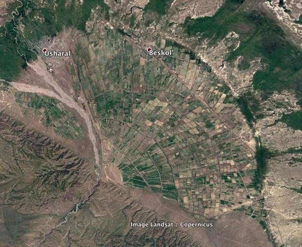
Image credits: imgur.com
“I’m always interested in how underlying geology affects human activity. This is a large alluvial fan in Kazakhstan. It must be more fertile than the surrounding areas because it is terraced and cultivated. It also seems to have a more active water source than most fans so irrigation is probably a factor too.”
interesting earth finds
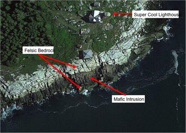
Image credits: imgur.com
“I cheated a little with this one. I’ve actually been to this place. It’s an island in Penobscot Bay, Maine, USA. We see 2 very distinctive rock bodies contacting one another. My guess is that the darker rock intruded into the lighter rock due to nearby volcanic activity. Nearby Vinalhaven Island is a very old volcano, and the direction kind of fits.”
interesting earth finds
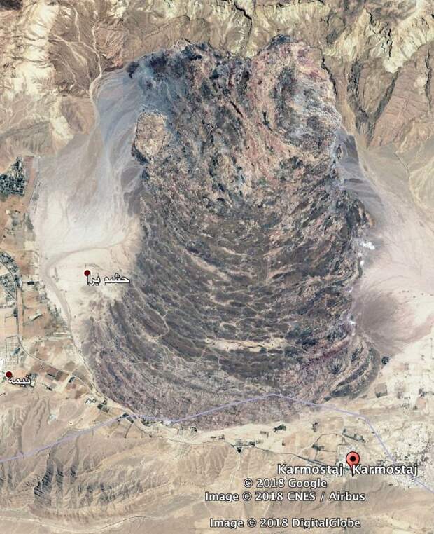
Image credits: imgur.com
“Salt Glacier in the mountains of Iran. There are many salt deposits around the world. They usually form when a seaway gets isolated or slightly isolated from a larger ocean. Evaporation will eventually make the small sea oversaturated and salts can precipitate on the sea floor. Some of these deposits can be Kms thick. When the salt gets pressured, either by the weight of sediments above or from tectonics, the salt will flow like a liquid. I’m guessing that this salt was pushed to the surface by tectonics. It’s now flowing from the ridge down into the valley.”
interesting earth finds
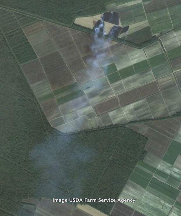
Image credits: imgur.com
“A sugarcane field burning in south Louisiana, USA. This is commonly done to remove all of the leftovers from harvesting. Sugarcane is a grass so there is a lot of organic material leftover.”
interesting earth finds
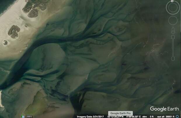
Image credits: imgur.com
“Underwater tidal channels of the Wadden Sea of Denmark.”
interesting earth finds
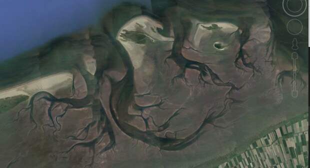
Image credits: imgur.com
“Still the Wadden Sea. Look at that tidal current rippin through there. This one is spooky.”
interesting earth finds

Image credits: imgur.com
“A very isolated island off the coast of Germany. What’s that? My first thought was it had to be ruins from a very old fortification or something. Turns out no. This little island was man made back in 1989. The features were put there to prevent wind erosion.”
interesting earth finds
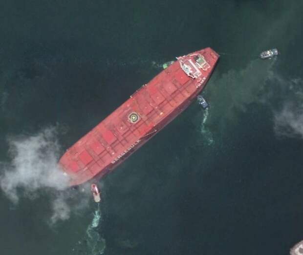
Image credits: imgur.com
“A huge ship getting some help in Brazil.”
interesting earth finds
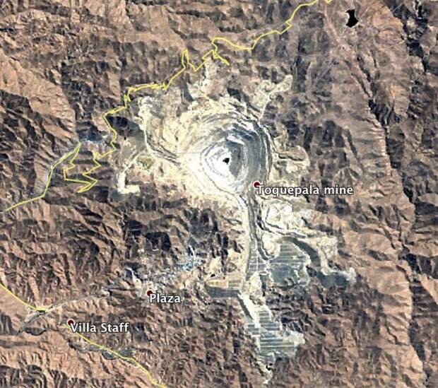
Image credits: imgur.com
“An open pit mine in the Andes. I can’t remember if it was Peru or Bolivia.”
interesting earth finds
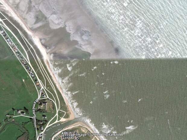
Image credits: imgur.com
“High vs. low tide on a Normandy beach.”
interesting earth finds

Image credits: imgur.com
“Mudflats in the Netherlands.”
interesting earth finds
Image credits: imgur.com
“Summer vs. winter in the Gulf of Finland.”
interesting earth finds
Image credits: imgur.com
“A beautiful wave-dominated delta in Brazil.”
interesting earth finds
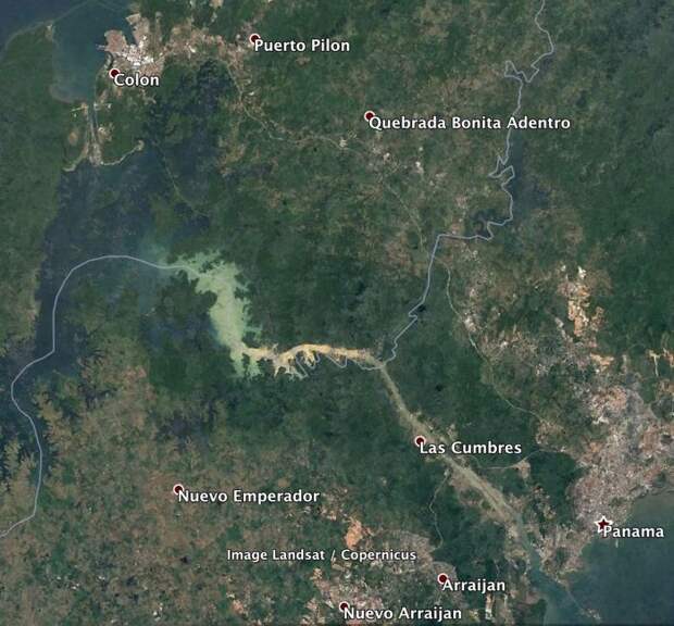
Image credits: imgur.com
“The Panama Canal. I didn’t realize so much of it was a lake. Colon (tee hee)”
interesting earth finds

Image credits: imgur.com
“A fort in the Netherlands.”
interesting earth finds

Image credits: imgur.com
“A lonely little gun emplacement that used to guard the entrance to Amsterdam. ”
interesting earth finds

Image credits: imgur.com
“Lets take a tour of the largest river in North America, the Mississippi. This interesting circular canal is locally called “the wagon wheel.” It is a series of canals for oil wells drilled around the flanks of a circular, subterranean salt dome.”
interesting earth finds
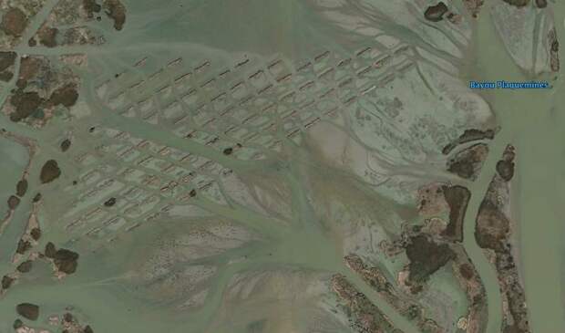
Image credits: imgur.com
“I’m not entirely sure what this is, but it is probably an effort to trap sediments in the marsh during floods. One of the biggest challenges to slowing the land loss down here is the low sediment supply of the river. One paper estimates that current sediment load is as much as 80% less than pre colonial levels. Mississippi.”
interesting earth finds
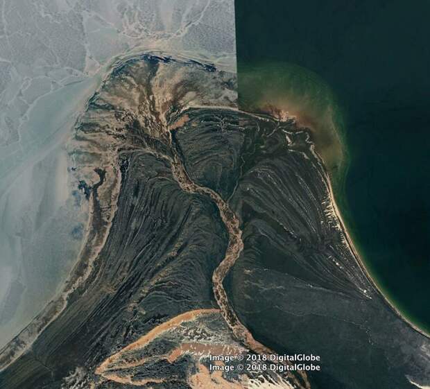
Image credits: imgur.com
“Above is the coolest delta I’ve ever seen. It’s formed by the William River, which flows through Athabasca Sand Dunes Provincial Park and into Lake Athabasca, Saskatchewan CA. This river has recently become my favorite river, because we share a name. The left side of the image seems to be while the lake is frozen but the river is not. The bands that sort of parallel the shoreline look like cheniers.”
interesting earth finds
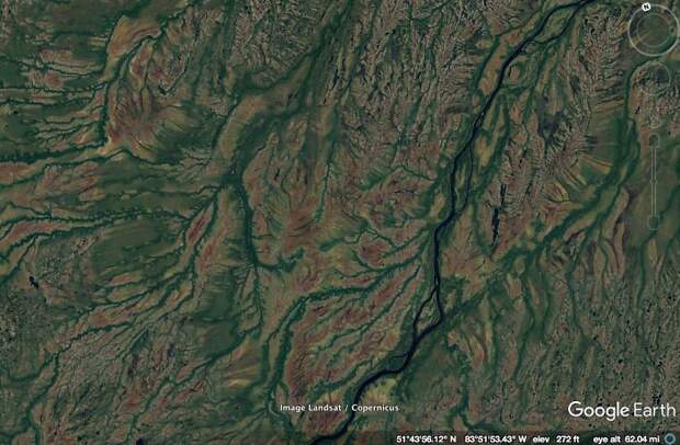
Image credits: imgur.com
“This is a random place in the Ontario, CA. I think the colors are very nice.”
interesting earth finds
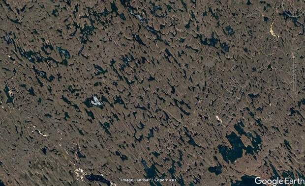
Image credits: imgur.com
“This one is a bit of a puzzle (also a random place in the Northwest Territories). There is a foliation or lineation in the land forms. There is a NW-SE trend to stuff. What caused that? These landforms are similar to things formed by flowing water or air. If that is the case, then the flow direction would come from the SE. The main shaper of landforms at this latitude were the last round of glaciers. They would have come from the N or NE. Maybe the land has been shaped by a couple thousand years of prevailing winds from the SE? Anyone from the middle of no-where Canada?”
interesting earth finds
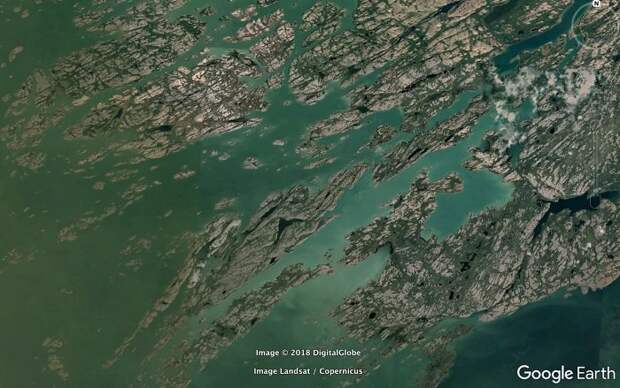
Image credits: imgur.com
“Oh look, fjords. This must be a high latitude coastline where glaciers shaped the landscape. Correct! But it’s a lake coastline. This is part of the Great Slave Lake in Northwest Territories, CA. I bet there haven’t been many people who’ve walked on that ground.”
interesting earth finds
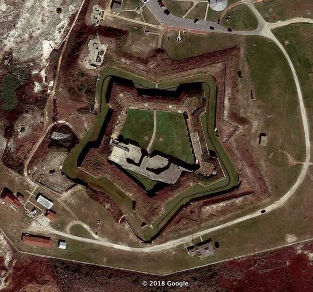
Image credits: imgur.com
“After the pretty bad performance of the US in the war of 1812, the federal government realized some things. They needed to maintain a larger, federally controlled, standing army. The states militias were just not up to the task when it came to real war. They also needed to have a larger navy. Privateers weren’t all that great either. Finally, they needed to fortify the border. The royal navy was able to sail all up in our waterways to deploy land forces. Since half of the US border was coastal, this meant lots of coastal forts to shoot at ships. Across the channel is Fort Morgan, a beautiful star fort. I’ve never been to this one, but it looks to be in very good shape. You can see the retrofitting of more modern gun emplacements.”
interesting earth finds
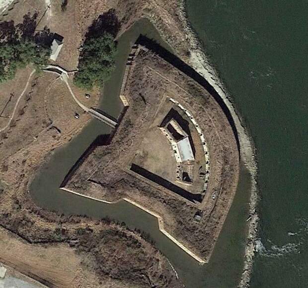
Image credits: imgur.com
“Traveling further east on US highway 90 we see the very similar Fort Pike. This was built to guard The Rigolets pass. It’s significantly better preserved than Fort Macomb and used to be open for tours. I went there about ten years ago. It was very neat, and there were 2 little goats that followed me around the whole time. Sadly it’s been closed since 2015.”
interesting earth finds
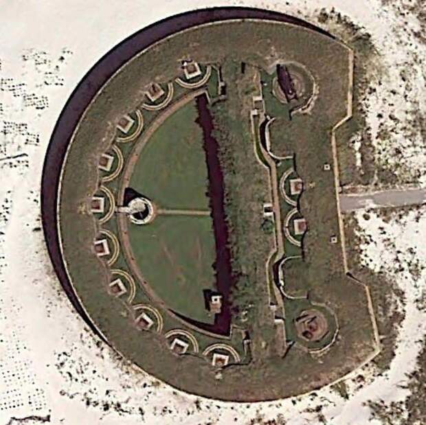
Image credits: imgur.com
“While there you can take a free guided tour of Fort Massachusetts. This fort was also designed to face its main threat from a primary direction. This one is definitely worth checking out. The fort was still under construction when the Civil War started, but unlike most forts, the confederate government finished it. It certainly helped that they made it a POW camp with all that free labor. You can see the change in the bricks in the walls. The lower bricks were pre war and from New York. The upper bricks are post war and from New Orleans. You can see this in the picture on Wikipedia. Ironically, the only action this fort saw was a small gun battle with a union ship called the USS Massachusetts. ”
interesting earth finds
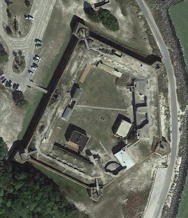
Image credits: imgur.com
“On the eastern tip of Dauphine Island is Fort Gaines. This fort is in very good shape (relatively speaking) and has quite an interesting history. It’s totally worth the visit. When I toured it someone was shooting a very low budget action movie there. I got to see the guy who played the white power ranger, or so I was told. ”
interesting earth finds

Image credits: imgur.com
“This one is particularly interesting. It’s on the southern coast of Spain. My first thought about all the white stuff was evaporation ponds for making sea salt.Turns out there are thousands of plastic covered hydroponic greenhouses. This region apparently grows a lot of veggies for the rest of Europe, but at substantial environmental costs. They also apparently use very mistreated immigrant labor from North Africa.”
interesting earth finds
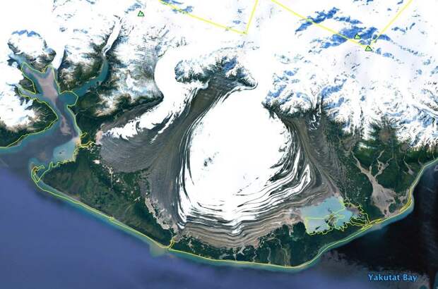
Image credits: imgur.com
“Alpine glaciers spilling out spreading across a flat plain. This is in SE Alaska.”
interesting earth finds
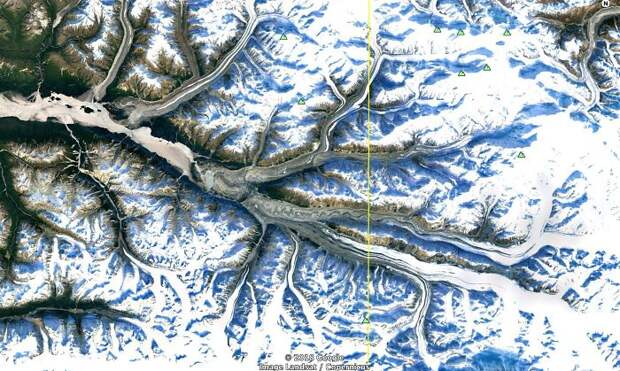
Image credits: imgur.com
“SE Alaska, multiple alpine glaciers flowing together.”
interesting earth finds
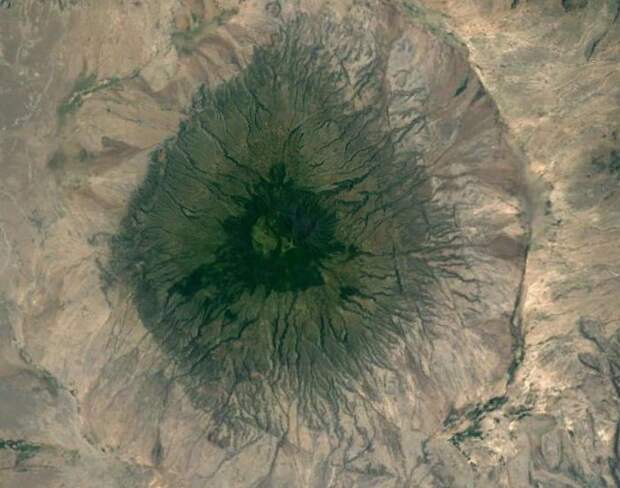
Image credits: imgur.com
“A volcano in the Great Rift Valley in Tanzania. It’s tall enough to have its own, wetter micro climate, hence the green.”
interesting earth finds
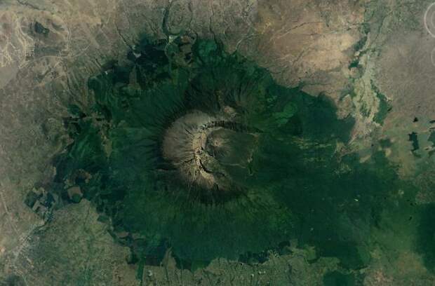
Image credits: imgur.com
“Another volcano in the Great Rift Valley with a micro climate and a very asymmetrical crater, much like Mt. St. Helens.”
interesting earth finds
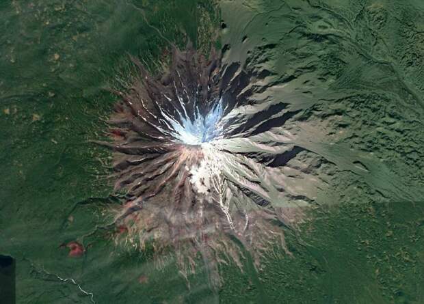
Image credits: imgur.com
“A beautifully symmetrical volcano on the Kamchatka Peninsula in Russia. Look at those weird red cinder cones on the flanks.”